
GTA 6 Mapping Project
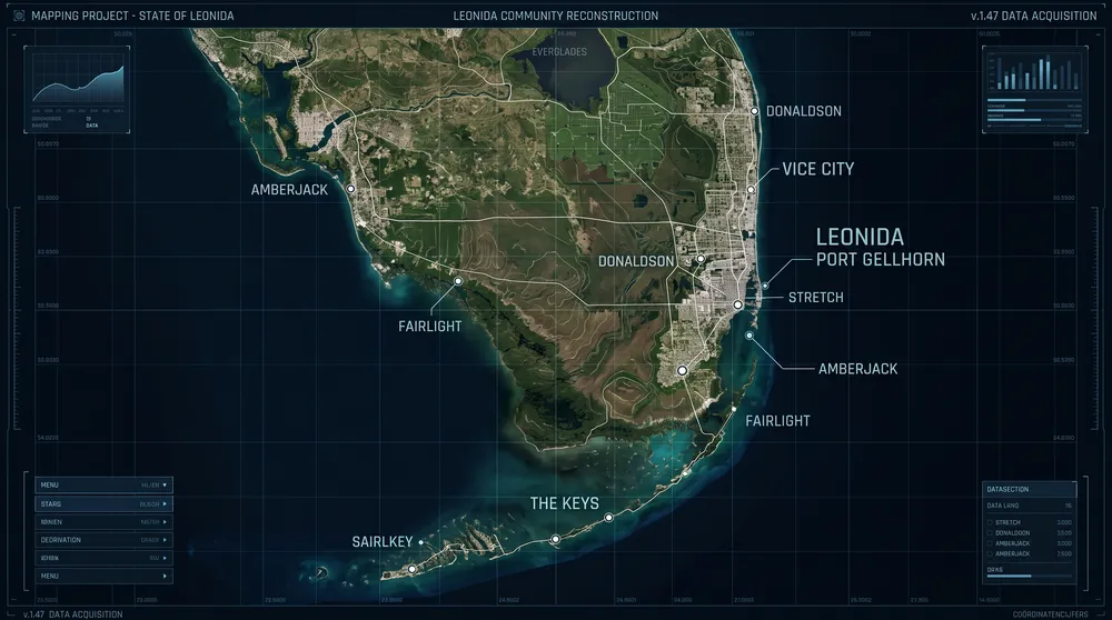
The official reveal trailers from Rockstar Games offered only fragmented glimpses of the state of Leonida, but community cartographers have spent months reconstructing the entire terrain. Known as the GTA 6 Mapping Project, this collaborative effort uses photogrammetry, engine coordinates, and mathematical sightline triangulation to build an accurate layout of the upcoming world.
Recent updates to the project have driven a major surge in search interest as players look to verify the total landmass of Vice City and its outlying regions.
How the Mapping Project Operates
The project functions similarly to the community map created prior to the launch of Grand Theft Auto 5 in 2013, which accurately predicted the final game geography months ahead of release.
-
Triangulation via Landmarks: Cartographers take identifiable points of interest visible across multiple angles, such as the Vice City skyline towers, highway signages, and industrial cranes, and calculate camera angles to place structures on a fixed vector grid.
-
Coordinate Extraction: Datamined internal coordinates from historical development footage provide verified metric distances between specific ground points.
-
Geographical Calibration: By cross-referencing real-world South Florida landmarks with in-game equivalents, the team plots road curves, waterway paths, and coastline boundaries.
Confirmed Regions and Points of Interest
The reconstructed layout confirms that Leonida extends far beyond the urban density of Vice City:
-
Vice City Proper: Dense urban neighborhoods featuring coastal beaches, hotel strips, port docks, and inland commercial financial districts.
-
The Keys (Gellhorn & Grassrivers): An extensive chain of low-lying islands connected by long highway bridges, requiring marine and aerial traversal.
-
The Marshlands and Swamps: Expansive rural bayous separating industrial settlements from the central metropolis, featuring unpaved tracks and localized wildlife zones.
-
Lake Leonida: A massive inland freshwater body anchored by agricultural and industrial processing towns.
Size Comparison: Leonida vs. Los Santos
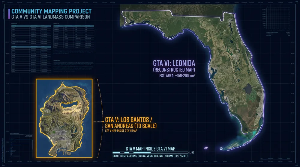
Current scale calculations indicate that the landmass of Leonida will be significantly larger than San Andreas in GTA 5. Estimates place the playable area at approximately 2.5 times the size of Los Santos and Blaine County combined. More importantly, the density of accessible building interiors and elevation variation points to a world with vastly improved spatial depth.


